Climate monitoring for Sri Lanka - Highlights
What is Drought
Drought is one of the most widespread natural hazards affecting human populations around the globe. Yet no universal definition of drought exists, because the concept fundamentally refers to insufficient water supply relative to a specific demand, both exhibiting considerable geographic and temporal variations. From a hydrometeorological perspective, a number of indices have been developed that emphasize different aspects of drought on varying time scales, at a particular location. The practical use of any of these indices is constrained by the extent to which they capture climate fluctuations of relevance to a particular drought-sensitive sector. In addition, such drought indicators need to be sufficiently precise at spatial scales fine enough for administrative responses.
Drought in Sri Lanka
Among the natural disasters in Sri Lanka, such as floods, landslides, cyclones, drought can be taken as one of the major natural disasters. Figure 1 shows the drought status of Sri Lanka for the months from April to June 2019. When the color is more brownish, then it can be concluded that extreme drought has occurred.
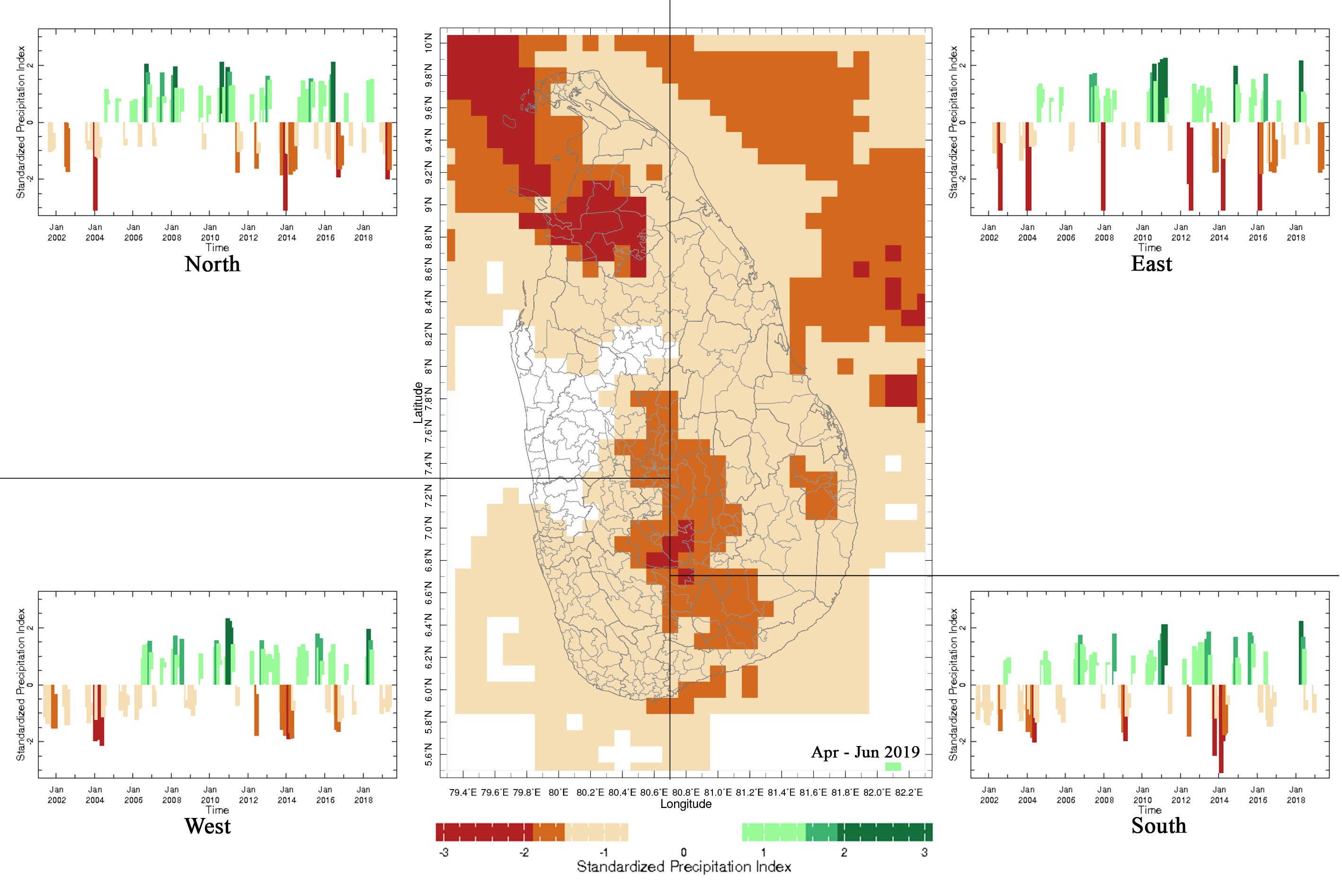
Figure 1: SPI Map for the Past Three Months of 2019 (Apr-Jun) and Three Monthly SPI Time Series for the 4 Climate Regions from May 2001 to June 2019
Rainfall in Sri Lanka
The 2 Panels below shows the variation by dekadal (3 times a month) and the map shows anomalies for the first half of the Maha Season 2018/19 starting from the month of September.
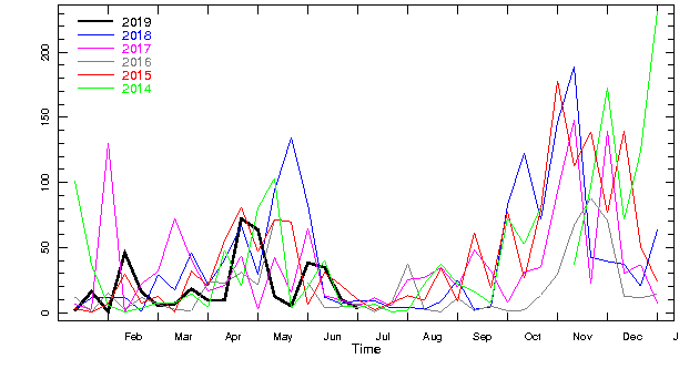
Figure 2: Comparison of Current Rainfall During the Past 6 Years
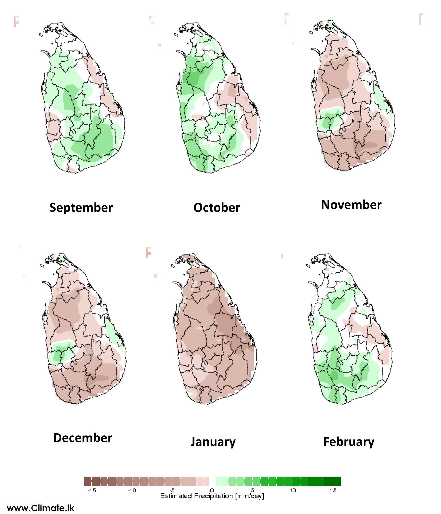
Figure 3 : Maha Season First Half 2018/2019 Anomalies for Each Month